Published by Leonardo Calcagno
Drones, also known as Unmanned Aerial Vehicles (UAVs), have revolutionized various industries by providing innovative solutions to traditional challenges. Their versatility, efficiency, and cost-effectiveness make them valuable tools for a wide range of applications. In this article, we will explore how drones can provide services, their role in data collection, the benefits they offer, and how they enhance management, mapping, planning, and analysis.
How Drones Can Provide Services
Drones have transformed many sectors by offering unique services that were previously difficult or impossible to achieve. Here are some ways in which drones can provide services:
1. Delivery Services
One of the most exciting applications of drone technology is in the field of delivery services. Companies like Amazon and Google are investing heavily in developing drone delivery systems. Drones can deliver packages quickly and efficiently, especially in remote or congested areas where traditional delivery methods might be slow or impractical. This not only speeds up the delivery process but also reduces the carbon footprint associated with ground transportation.
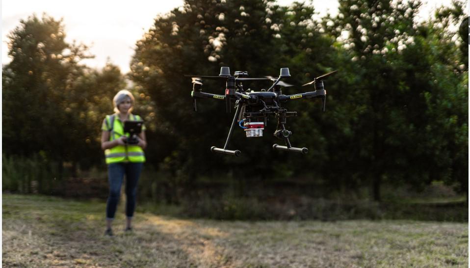
2. Agriculture
In agriculture, drones provide critical services such as crop monitoring, spraying pesticides, and mapping fields. They can cover large areas quickly, providing farmers with detailed insights into crop health, soil conditions, and potential problem areas. This enables farmers to make informed decisions, optimize resource usage, and increase yields.
3. Infrastructure Inspection
Drones are increasingly used for inspecting infrastructure such as bridges, power lines, and pipelines. They can access hard-to-reach areas and capture high-resolution images and videos, allowing engineers to assess the condition of structures without the need for costly and dangerous manual inspections. This improves safety and efficiency while reducing inspection costs.
4. Disaster Response
In disaster response, drones play a crucial role by providing real-time aerial views of affected areas. They help emergency responders assess damage, locate survivors, and deliver supplies to inaccessible regions. This rapid response capability can save lives and accelerate recovery efforts.
How Drones Help in Data Collection
Data collection is one of the primary functions of drones, and their ability to gather accurate and detailed data has far-reaching implications across various fields.
1. Environmental Monitoring
Drones equipped with sensors and cameras can monitor environmental conditions such as air quality, water quality, and wildlife populations. They can collect data in real time and over large areas, providing scientists with valuable information for research and conservation efforts. For example, drones can track deforestation, monitor endangered species, and detect pollution sources.
2. Surveying and Mapping
In surveying and mapping, drones provide high-resolution aerial imagery and 3D models of terrain and structures. This is particularly useful in construction, mining, and urban planning. Drones can quickly survey large areas, reducing the time and cost associated with traditional ground-based methods. The data collected can be used to create accurate maps, plan projects, and monitor progress.
3. Precision Agriculture
In precision agriculture, drones collect data on crop health, soil moisture, and plant growth. They use multispectral and thermal sensors to capture detailed images that reveal variations in crop conditions. Farmers can use this data to optimize irrigation, fertilization, and pest control, leading to increased productivity and reduced resource usage.
4. Security and Surveillance
Drones are also used in security and surveillance to monitor large areas and detect potential threats. They can be equipped with night vision cameras, thermal imaging, and other advanced sensors to provide continuous monitoring in various conditions. This is particularly useful for border security, event management, and protecting critical infrastructure.
Benefits of Using Drones
The use of drones offers numerous benefits that enhance efficiency, accuracy, and cost-effectiveness in various applications.
1. Cost Savings
Drones can significantly reduce costs associated with traditional methods of data collection, inspection, and delivery. They eliminate the need for expensive equipment, labor-intensive processes, and long transportation times. For example, using drones for infrastructure inspection can save on scaffolding, cranes, and manual labor.
2. Increased Safety
Drones enhance safety by reducing the need for humans to work in hazardous conditions. Whether it’s inspecting tall structures, monitoring disaster zones, or surveying rough terrain, drones can perform these tasks without putting human lives at risk. This is particularly valuable in industries such as construction, mining, and emergency response.
3. Time Efficiency
Drones can complete tasks much faster than traditional methods. They can cover large areas quickly, provide real-time data, and reduce the time needed for inspections, surveys, and deliveries. This time efficiency translates into faster decision-making and project completion.
4. Precision and Accuracy
Equipped with advanced sensors and GPS technology, drones can collect highly precise and accurate data. This level of detail is invaluable for applications such as mapping, surveying, and precision agriculture. The ability to gather accurate data helps in making informed decisions and optimizing processes.
5. Accessibility
Drones can access areas that are difficult or impossible to reach by traditional means. This includes remote regions, dangerous environments, and confined spaces. Their ability to operate in diverse conditions makes them ideal for a wide range of applications, from environmental monitoring to infrastructure inspection.
How Drones Help in Management, Mapping, Planning, and Analysis
Drones play a vital role in enhancing management, mapping, planning, and analysis by providing detailed and accurate data that informs decision-making and improves efficiency.
1. Management
In management, drones provide real-time data that helps organizations monitor and manage their operations more effectively. For example, in agriculture, drones can monitor crop health and growth, allowing farmers to manage their fields more efficiently. In construction, drones can track project progress and ensure that work is being carried out according to plan.
2. Mapping
Drones excel in mapping by capturing high-resolution aerial images and creating detailed 3D models of terrain and structures. This is useful in urban planning, construction, and environmental conservation. Accurate maps and models provide valuable insights for planning and development, helping to optimize land use and resource allocation.
3. Planning
Drones assist in planning by providing detailed data that informs decision-making. For example, in construction, drones can survey sites and create accurate topographical maps, helping planners design efficient layouts and identify potential challenges. In agriculture, drones can analyze soil conditions and crop health, guiding farmers in planning planting and harvesting schedules.
4. Analysis
The data collected by drones is invaluable for analysis in various fields. In environmental monitoring, drones can track changes in ecosystems and analyze the impact of human activities. In infrastructure inspection, drones can identify structural issues and assess maintenance needs. This data-driven analysis helps organizations make informed decisions and improve their operations.
Case Study: Drones in Disaster Management
One of the most compelling examples of drone technology in action is its use in disaster management. During natural disasters such as hurricanes, earthquakes, and floods, drones provide critical support in several ways:
-
Rapid Assessment: Drones can quickly survey affected areas and provide real-time data to emergency responders. This allows for rapid assessment of damage and identification of areas that require immediate attention.
-
Search and Rescue: Equipped with thermal imaging and high-resolution cameras, drones can locate survivors trapped in debris or stranded in remote areas. They can cover large areas quickly, increasing the chances of finding and rescuing survivors.
-
Delivery of Supplies: In inaccessible regions, drones can deliver essential supplies such as food, water, and medical equipment. This ensures that aid reaches those in need quickly and efficiently.
-
Monitoring and Recovery: After the initial response, drones continue to monitor affected areas and assess the progress of recovery efforts. They provide valuable data that helps in planning and implementing reconstruction projects.
Conclusion
Drones have become indispensable tools in various industries, offering unique services, enhancing data collection, and providing numerous benefits. Their ability to improve management, mapping, planning, and analysis has far-reaching implications, making them valuable assets in today’s technology-driven world. As drone technology continues to advance, its applications will only expand, providing even greater opportunities for innovation and efficiency.
For businesses and individuals in Halifax and beyond, embracing drone services can lead to significant improvements in operations, cost savings, and overall effectiveness. Whether it’s delivering packages, monitoring crops, inspecting infrastructure, or responding to disasters, drones offer a versatile and powerful solution that is transforming the way we live and work. By leveraging the capabilities of drones, organizations can stay ahead of the curve, enhance their services, and achieve greater success in their respective fields.